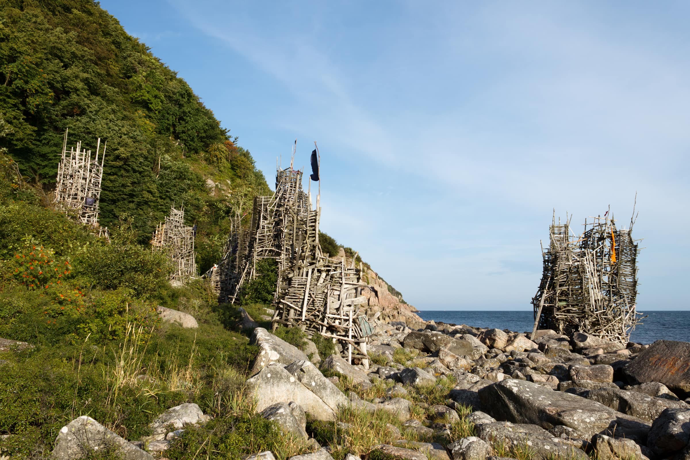
Nimis, Lars Vilks' towers of driftwood and timber on the shore below Kullaberg, is on none of the nature reserve's maps or signs. The shortest way there follows official trail marks from Himmelstorp to a turn-off in the woods. Then unofficial yellow N's lead steeply down to the sea. Vilks painted the first ones himself, to guide the growing crowds.
On the way there the path climbs only about 30 m, then drops about 145 m to the shore, so the real climb comes on the way back. Going down usually takes 30–40 minutes and coming back longer; allow 2–3 hours in all, including your time at Nimis.
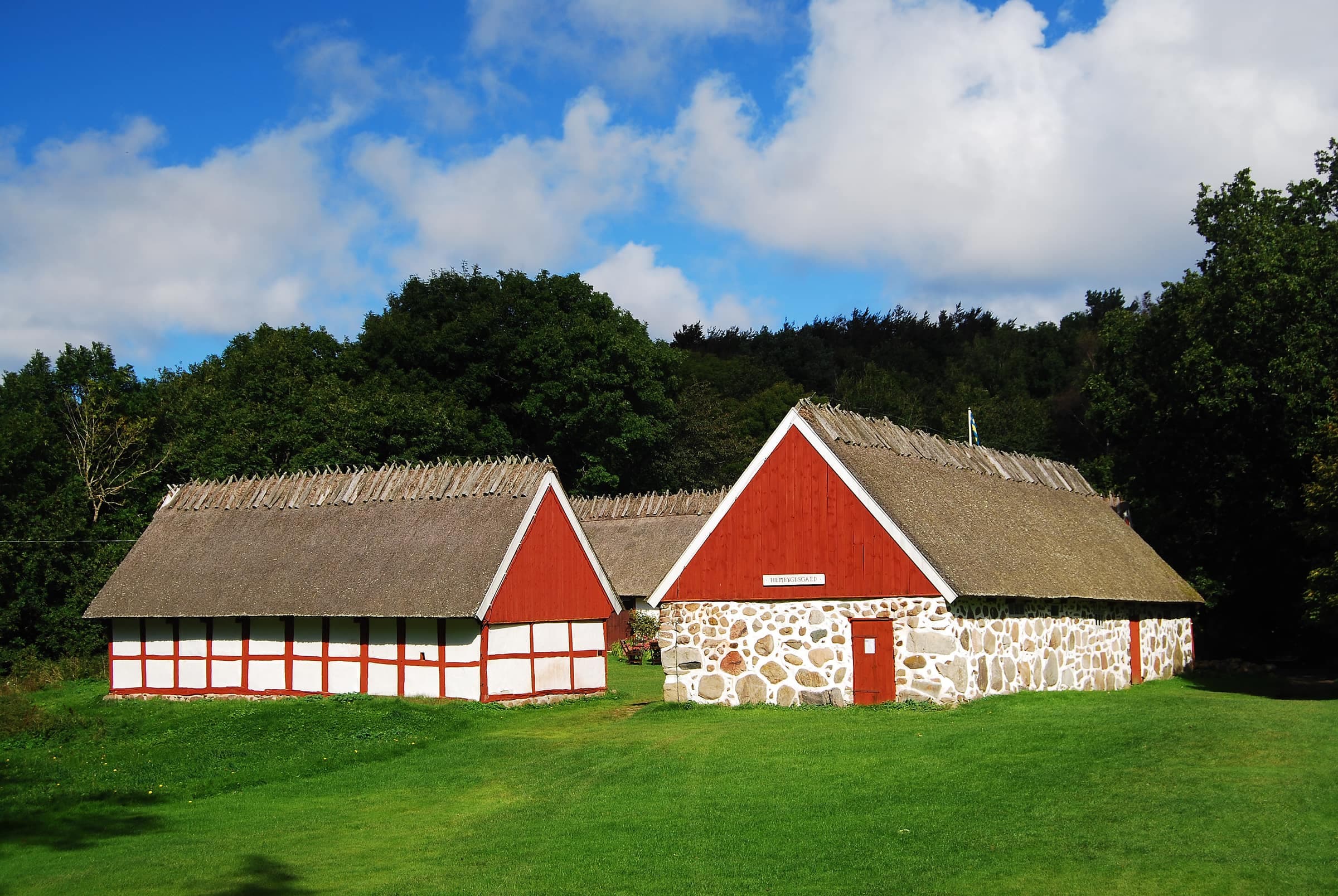
Himmelstorp's thatched, half-timbered farm buildings
Photo: Cyhall · CC BY-SA 3.0A hooded crow takes off from a rail painted "← NIMIS 1,2" near Himmelstorp, 2009
Photo: karendesuyo · CC BY 2.0A steep plank stairway through Nimis under fresh beech leaves, visitors at the top, May 2020
Artwork: Lars Vilks · Photo: GandalfRiju · CC BY-SA 4.0The route
- 1
Upper car park
drive past the lower car park to the smaller upper one, about 400 m on.
- 2
climb the short stairs and walk about 250 m to the farm. Pass to the right of its buildings, then keep straight on past an old, gnarled oak.
- 3
Two gates
the path crosses a cattle pasture. Close each gate behind you.
- 4
Orange marks
follow Kullaleden's orange marks toward Håkull, on a stretch shared with the Blue trail. After about 350 m the path bends left; go on about 200 m.
- 5
The yellow N
an N with an arrow pointing right, painted on a slender trunk, marks the turn-off down to Nimis.
- 6
The last 400 m
steep, narrow, stony and full of roots, this stretch alone drops about 120 m to the shore. You'll need your hands for balance both ways.
If you reach the Iron Age stone circle, you've gone wrong: go back to the farm and take the path to its right. At forks, keep right.
Along the way
- HimmelstorpsgårdenHimmelstorp's half-timbered farm, first recorded in the 1400s and a listed building since 1978. Its summer café is a popular stop on the way back.
- Beech woodshalf a kilometer in, the path tops out at about 145 m above sea level, then heads down through beech, oak, birch and hazel.
- The N'sVilks' first N's date from 1982 or 1983. According to Vilks, when the reserve's managers cut many off the trees around 2015–16, his helpers restored them all. In August 2024 Ladonia, the micronation around Nimis, launched volunteer Nimis Guides, who wear green GUIDE buttons and give directions.
Good to know
- WaymarksKullaleden's orange marks and the Blue trail's blue ones lead to the turn-off; yellow N's mark the rest. Handwritten arrows to Nimis come and go.
- At your own riskLänsstyrelsen, which manages the reserve, doesn't recommend going down to Nimis. According to Vilks, most accidents happen on the slope and the beach boulders. Wear sturdy shoes with a good grip.
- Not for everyonethe walk doesn't suit small children, anyone unsteady on their feet or anyone with bad knees, and strollers and wheelchairs can't get down. The 800 m Björkeröd purple loop, made for wheelchair users, is an easy alternative.
- Weatherafter rain the path turns muddy, and roots, stones and the rocks at the bottom get slippery; in autumn, fallen leaves hide them. Hot days make the climb back hard.
- Water and toiletsbring all your water: there's none at Nimis, and don't count on any at Himmelstorp. The only toilets are by the upper car park and near the farm. If you plan to stop at Himmelstorpsgården's summer café, check its hours first.
- Emergenciescall 112 and give the nearest rescue point's number. Point 23 stands by the path about 140 m past Himmelstorpsgården; there is none at the shore, and help may be slow.
- Dogson a leash all year. They usually can't manage the boulder beach.